
Dev Blog #52
Hello, comrades!
Before the release of Korea, we plan to devote several dev blogs to the graphical user interface. Earlier, in Dev Blog #40, we showcased the Commander Career mode interface and discussed the new features it offers. Today, we will talk about the game settings and the navigation map.
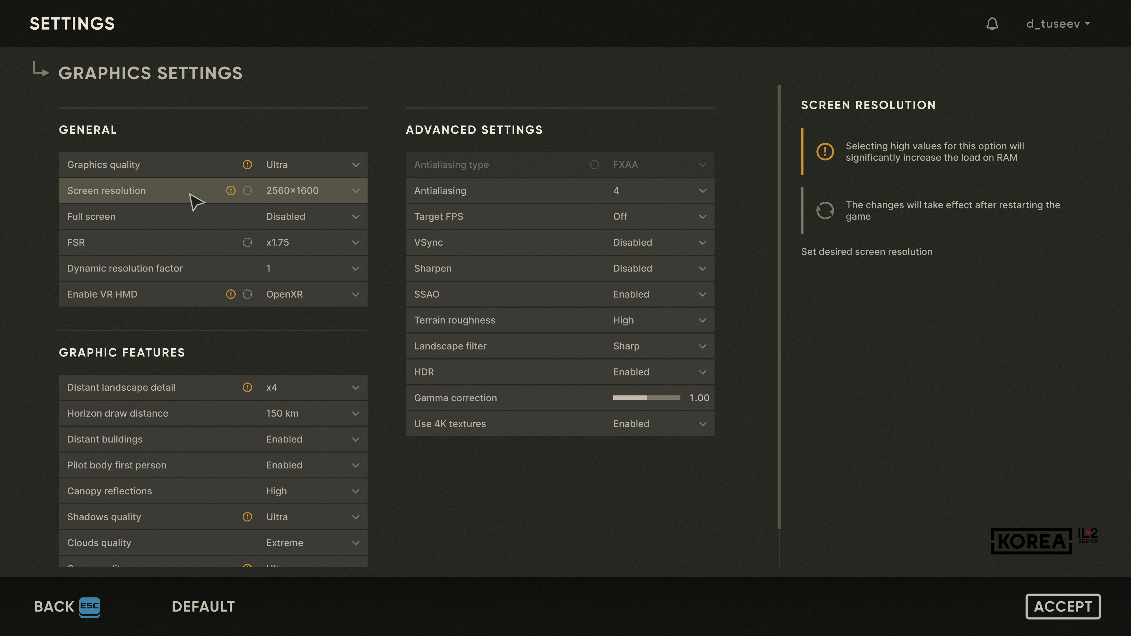
In the settings, we tried to take into account the wishes and comments that players expressed based on their experience playing Great Battles. Thus, the graphics settings have been grouped more logically, and symbols and hints have been added to help you optimize your game settings. New options include the choice of virtual reality API (Open VR or Open XR), the degree of image scaling using FSR technology, the inclusion of the pilot’s body in the first-person view, and a special VR-optimized graphics preset.
Before the release of Korea, we plan to devote several dev blogs to the graphical user interface. Earlier, in Dev Blog #40, we showcased the Commander Career mode interface and discussed the new features it offers. Today, we will talk about the game settings and the navigation map.
In the settings, we tried to take into account the wishes and comments that players expressed based on their experience playing Great Battles. Thus, the graphics settings have been grouped more logically, and symbols and hints have been added to help you optimize your game settings. New options include the choice of virtual reality API (Open VR or Open XR), the degree of image scaling using FSR technology, the inclusion of the pilot’s body in the first-person view, and a special VR-optimized graphics preset.
The control settings have undergone much more significant changes — a lot of effort has been made to make this, perhaps, the most complex interactive dialogue in the game interface, more understandable and readable. A combination of bookmarks and filters has been used to make command sorting more convenient. Commands have unique numbers to make it easier to understand which command is being referred to when communicating between players or between players and developers. The commands themselves have been given new, clearer, and more readable names. The key and axis combinations assigned to each command are displayed using special, easy-to-understand infographics. Thanks to the new design, we were able to remove the Great Battles limitation, which previously allowed only three key combinations to be assigned to a single command.
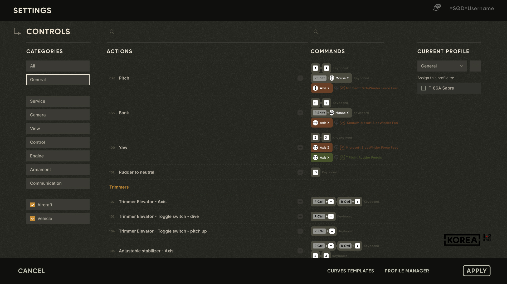
In addition to this, there will be a new control assignment wizard when you first enter the game, which we will show a little later. At the same time, all the developments in control profiles, axis response curve profiles, and their binding to aircraft that we had previously developed in Great Battles have been preserved. There are new built-in aircraft control response modes: "Direct Link with Limits" and "Dynamically Renormalized Link with Limits." Both of these modes can be combined with an optional unique response curve specially prepared for each aircraft by our engineers. Combinations of these settings will allow you to control the aircraft as conveniently as possible using various categories of joysticks (consumer short- and long-travel ones, force-sensing, with and without feedback), as well as gamepads.
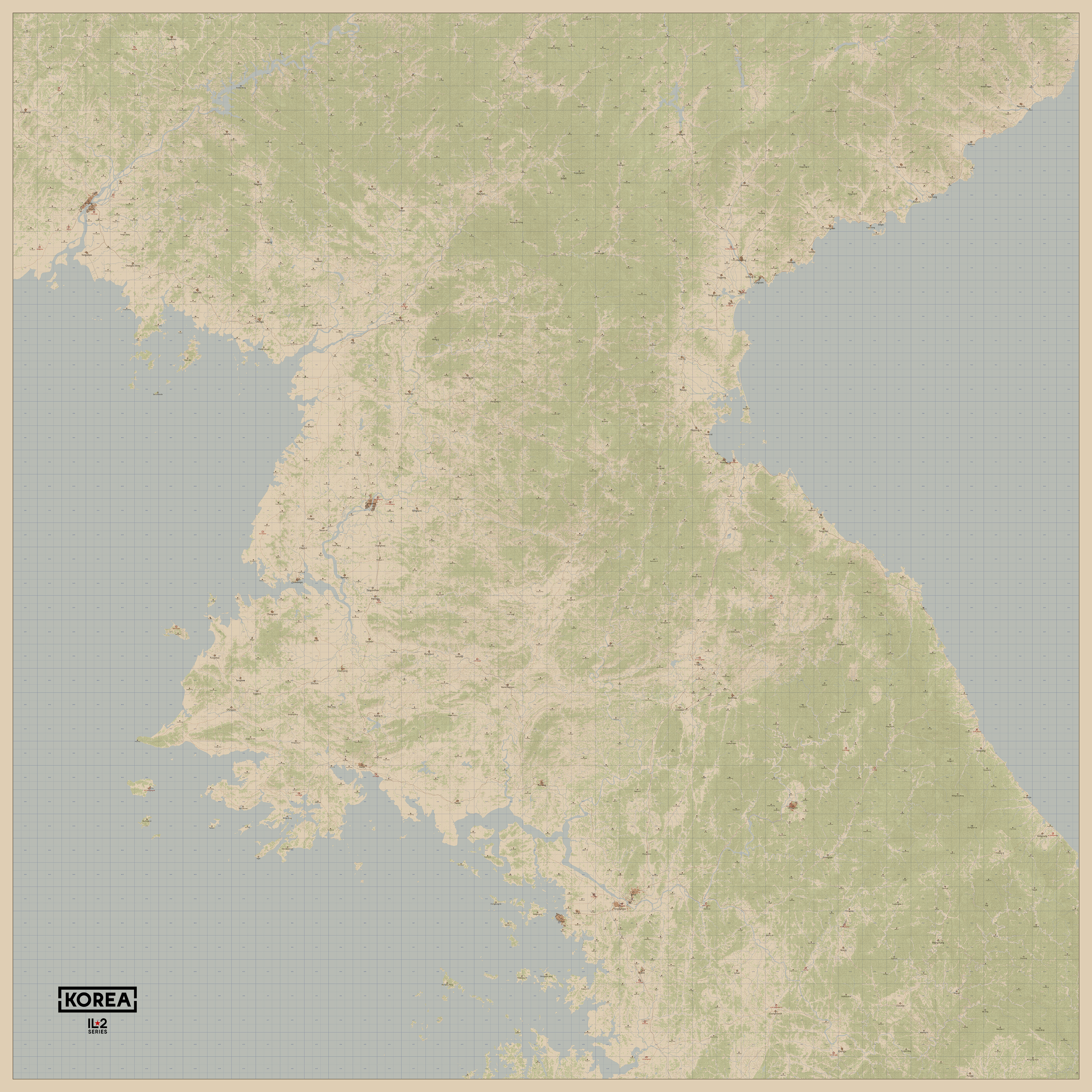
A highly detailed navigation map has always been a central element of the interface in all the games created by our team: Rise of Flight, Great Battles, and now Korea. The use of a new API interface has enabled the optimization of its rendering to be performed extremely effectively in terms of performance. Complex structures consisting of many dynamic elements on the map, which, as it turned out during the development of the "Marshal" mode in Great Battles, were impossible to implement with acceptable performance using the Scale Form API, now work quite well and quickly using the new Noesis API. Of course, it didn't work that fast right out of the box — we did a lot of work on writing the application part of this functionality, but the result turned out to be very good.
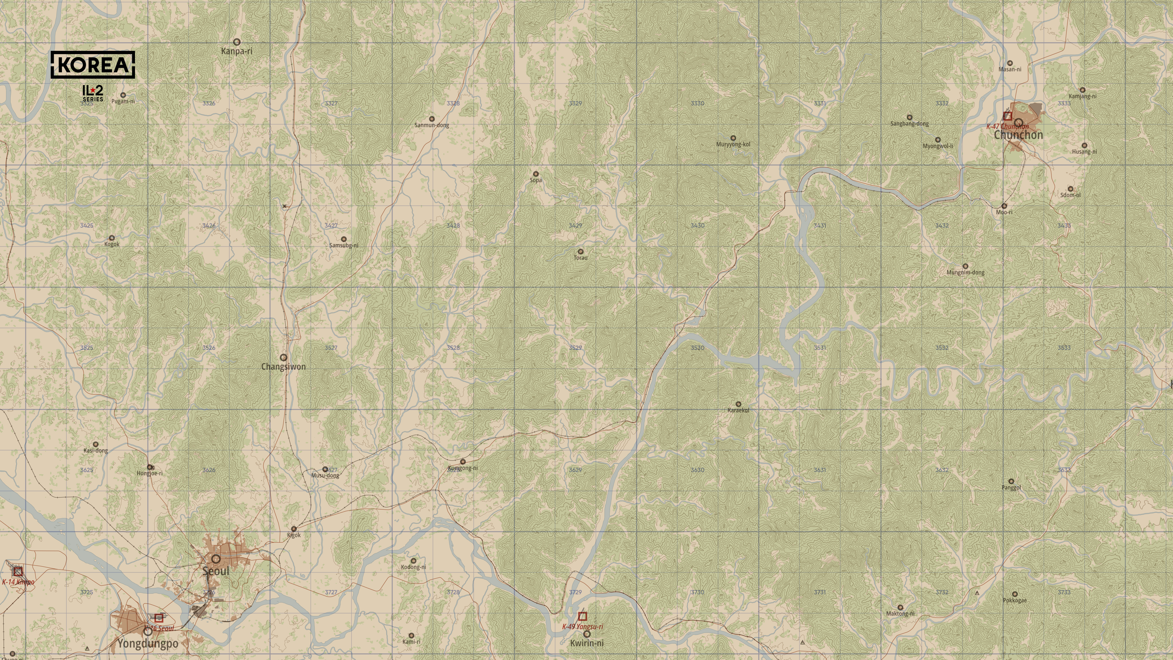
When working on the interface design, our artists adhered to a unified style — the map resembles an authentic document from the early Cold War era, and numerous details have been added to it, including elevations, more detailed layouts of settlements, industrial zones, and a more detailed vegetation map. All this was made possible by increasing the map resolution several times over, thanks to the transition to the new API.
When working on the interface design, our artists adhered to a unified style — the map resembles an authentic document from the early Cold War era, and numerous details have been added to it, including elevations, more detailed layouts of settlements, industrial zones, and a more detailed vegetation map. All this was made possible by increasing the map resolution several times over, thanks to the transition to the new API.
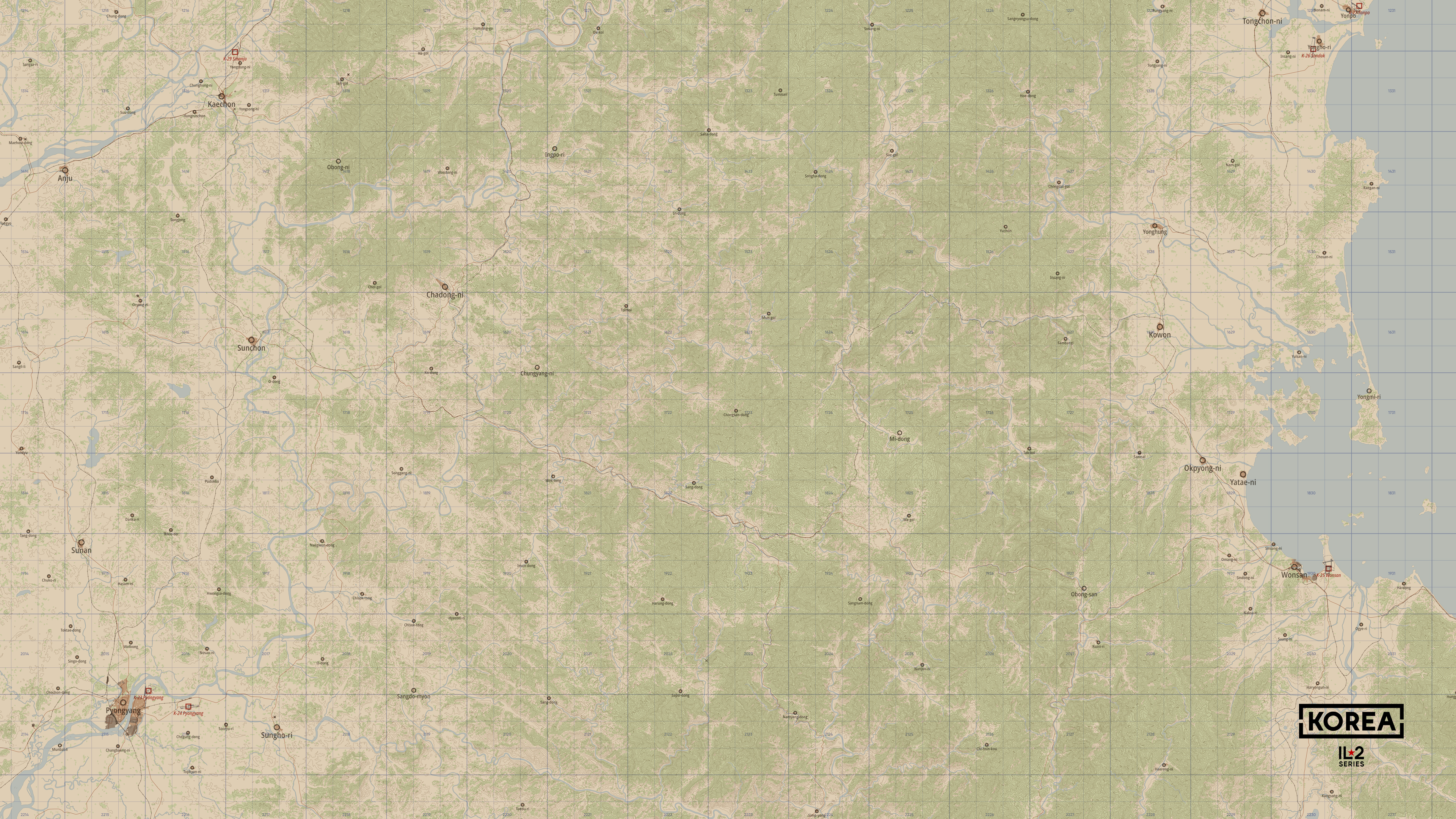
Even the approach to creating a navigation map has undergone significant changes. Now it is made by a specially written program that utilizes the existing in-game landscape, rather than simply scanning an old map of Korea; it is precisely the landscape that is recreated in the simulation, with all its details already present in the game terrain. This conversion outputs an array of vector data that can be saved in the final raster image tiles, with any required resolution. This has made the map creation technology as flexible as possible and has also enabled inscriptions on the map in the selected language, which was previously impossible.
In any game mode, you will have at your disposal such standard tools as a ruler (with which you can draw a route), a protractor, and the ability to set markers. In multiplayer games, up to 4 markers from one player will be visible to other team members and accompanied by captions limited to Latin characters.
In the next Dev Blogs, we will talk about other graphical user interface modules for Korea. IL2 Series.